Preston River Information Page
Link to NWS Ostrander Graph Page
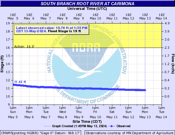
Link to NWS Carimona Graph Page
Link to NWS Carimona Tabular Data Page
Link to DNR Carimona Graph Page
Link to NWS Crystal Creek Page
Link to NWS Preston Graph Page
Link to NWS Lanesboro Graph Page
Link to USGS Pilot Mound Graph Page
Carimona - Preston - Impact
13.0 - 930.5 - Water over Bike Trail under South Bridge
14.0 - 932.0 - Water over Bike Trail under East Bridge
18.0 - 935.5 - Water over Truck Route
19.7 - 937.3 - Water over Fillmore Street by Trailhead and West River Road
River Levels and impacts are based on historic observations and are Approximate
Historically the Preston crest has been 5 hours after the Carimona crest